Newsletter · 24 August 2026
Submission on Celbridge Road Active Travel Scheme
post@maynoothcyclingcampaign.com
SUBMISSION ON THE
CELBRIDGE ROAD ACTIVE TRAVEL SCHEME
PLANNING REFERENCE P82026.02
Executive Summary Maynooth Cycling Campaign welcomes the Celbridge Road Active Travel Scheme, which will bring real benefits in safety, convenience, and a more pleasant environment for residents, school commuters, and local travellers alike.
The proposals in this submission build on those foundations, to integrate the scheme more tightly with the town’s changing traffic patterns, in particular, the orbital routes now under construction.
In summary, we recommend:
Include the missing section for pedestrians and cyclists between the Rail Park and the Straffan Road
Provide a safety buffer between cyclists and motor traffic where space allows
Reduce traffic lane widths to the TII minimum in order to lower speeds
Design minor junctions with entrance kerbs that reinforce the priority of pedestrians and cyclists
Minimise the use of shared space
Quantify and communicate the benefits of the active traffic scheme to the people of Maynooth.
1.0 Introduction
Today, the Celbridge Road deters active travel. Parents worry about their children cycling or walking to school here because the path is narrow and cars are too close. Instead, children are driven, increasing traffic in the town.
The Irish Design Manual for Urban Roads and Streets (DMURS) addresses these concerns by prioritising road users, beginning with pedestrians and then cyclists. Although the Celbridge Road upgrade is very welcome, we have reservations that the design doesn’t establish that clear hierarchy for active travel, and the quality of the planned infrastructure is not convincing enough to shift people from driving to walking or cycling. Without addressing these matters, another generation of children will miss the freedom and independence of walking and cycling to school in safety.
We would also urge the Council to reconsider the section between the Rail Park and the Straffan Road, which the scheme as it stands omits. A travel route is only as good as its weakest point, and this gap will limit overall usage. With no land take needed, a Section 38 order would cover this, and we urge the Council to develop that option.
2.0 Cycle Lanes & Forgiving Design
A key principle of road safety is that designs should be forgiving: a mistake should not result in death or serious injury.
The proposed design offers light segregation to cyclists through a 50-75 mm high kerb. This lessens vehicular collision risk, but not as much as full segregation, and is not forgiving for young and less experienced cyclists, as it places them beside motor traffic with no buffer.
With road safety as a stated priority, this should be reflected in the final design: a buffer to protect vulnerable road users. We recognise the space constraints, but for a significant part of the scheme, this could be achieved through one of the two options described in the following sections.
Option A - Provide a buffer by making Celbridge Road one-way outbound for motorised traffic and reallocate the road space to cycling and walking.
Reducing motor traffic to one lane outbound towards Celbridge would free up road space for wider cycle lanes and allow the inclusion of a safety buffer. It would also give more green time to cars at the traffic lights on the R406 Straffan Road, as traffic would no longer come from the Celbridge Road. This would improve traffic flow throughout the town.
Diverting motorised traffic away from active travel routes by separating the modes is a principle of the well-proven Dutch Sustainable Safety approach: direct routes for active travel, and longer, indirect routes for motorised traffic.
Given the substantial public investment in the town’s ring roads, maximising their use makes sense. The new Griffin Rath /Mullen Park road is wider and built to a higher design standard than the Celbridge Road. The new section of the Eastern Ring Road (MERR) between the Celbridge and Dublin roads is now being built, with further sections to follow, and will serve through-traffic well.
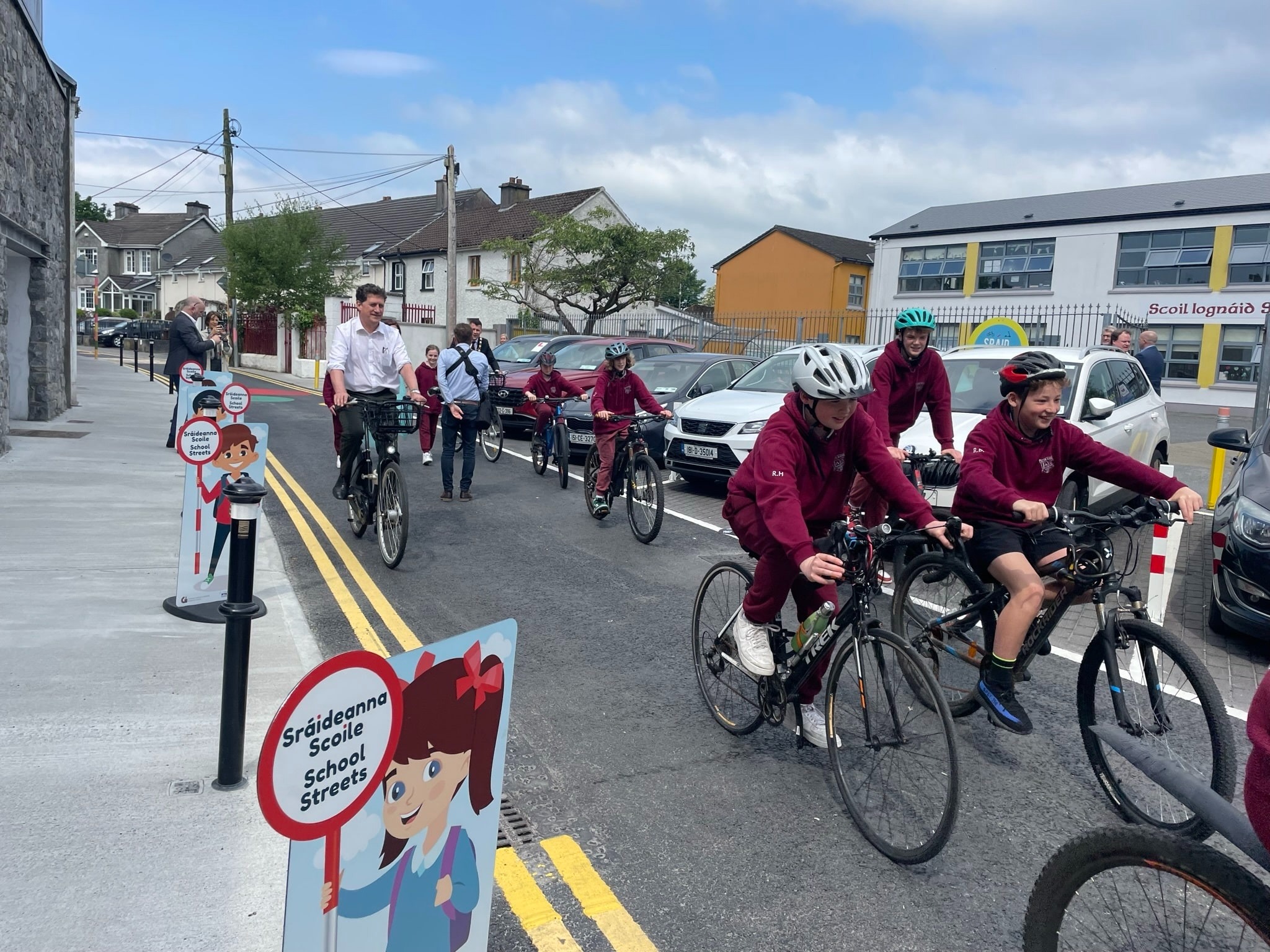
Option B - Remove the southern cycle lane on the Celbridge Road and convert the appropriate sections of Laurence’s Avenue and Rail Park to School Streets for walking and cycling.
What are School Streets?
School Streets are designated zones outside schools where vehicular access is restricted to certain times of day (typically during drop-off and pickup times), creating safer, healthier spaces for children and the wider community.
—NTA: School Streets Guidance – 2025 Safe Routes to School
[image: image.jpeg]In many places, people commonly cycle on service roads such as Rail Park and Laurence Avenue. With light traffic volumes, no dedicated cycle facilities or buffers are needed, as the risk to active travellers is low.
When schools are built on major traffic roads, implementing a School Street is difficult. However, adding a permeability filter would change the de facto function of Laurence Avenue from a through route to a local road, allowing School Streets to be introduced with the ensuing improvement in road safety.
Removing the southern cycle lane on Celbridge Road would free additional space for active travel on the north side and allow the design to be forgiving. Laurence Avenue is the obvious choice for a School Street: it runs almost 435m from the Straffan Road to Gaelscoil Uí Fhiaich.
Note: Maynooth Educate Together NS is enrolled in the NTA’s Safe Routes to School (SRTS) programme that has been instrumental in pioneering School Streets in Ireland, and should be included in these discussions. There may even be additional funding available.
[image: image.jpeg]
Raleigh Row, Galway, serving Scoil Iognáid, with authorised vehicle access
Recommendation 1 : Our first preference would be for Option A but Option B would also be acceptable.
3.0 Width of Proposed Traffic Lane
The proposed traffic lanes are 3.15m each (6.3m for two lanes)—0.3m wider than the TII standard for a regional road.
Wider lanes are associated with higher traffic speeds and a greater risk of injury. Nationwide, road deaths are rising. In the first half of 2026, eight more people died on Irish roads than in the same period in 2025, bringing the total to 85 deaths. According to the RSA (2026), almost half of those killed were vulnerable road users, including those on foot, bicycles, motorcycles, and e-scooters.
Minimising lane width is a straightforward way to reduce speed and protect vulnerable road users on the Celbridge Road.
Recommendation 2 : Reduce the risk of a fatality or serious injury by reducing the road width to the minimum permitted under TII standards.
4.0 Minor Junctions
In the Netherlands and elsewhere, where a footpath and cycle track on a major road cross a minor road, both continue across the junction, maintaining priority for pedestrians and cyclists.
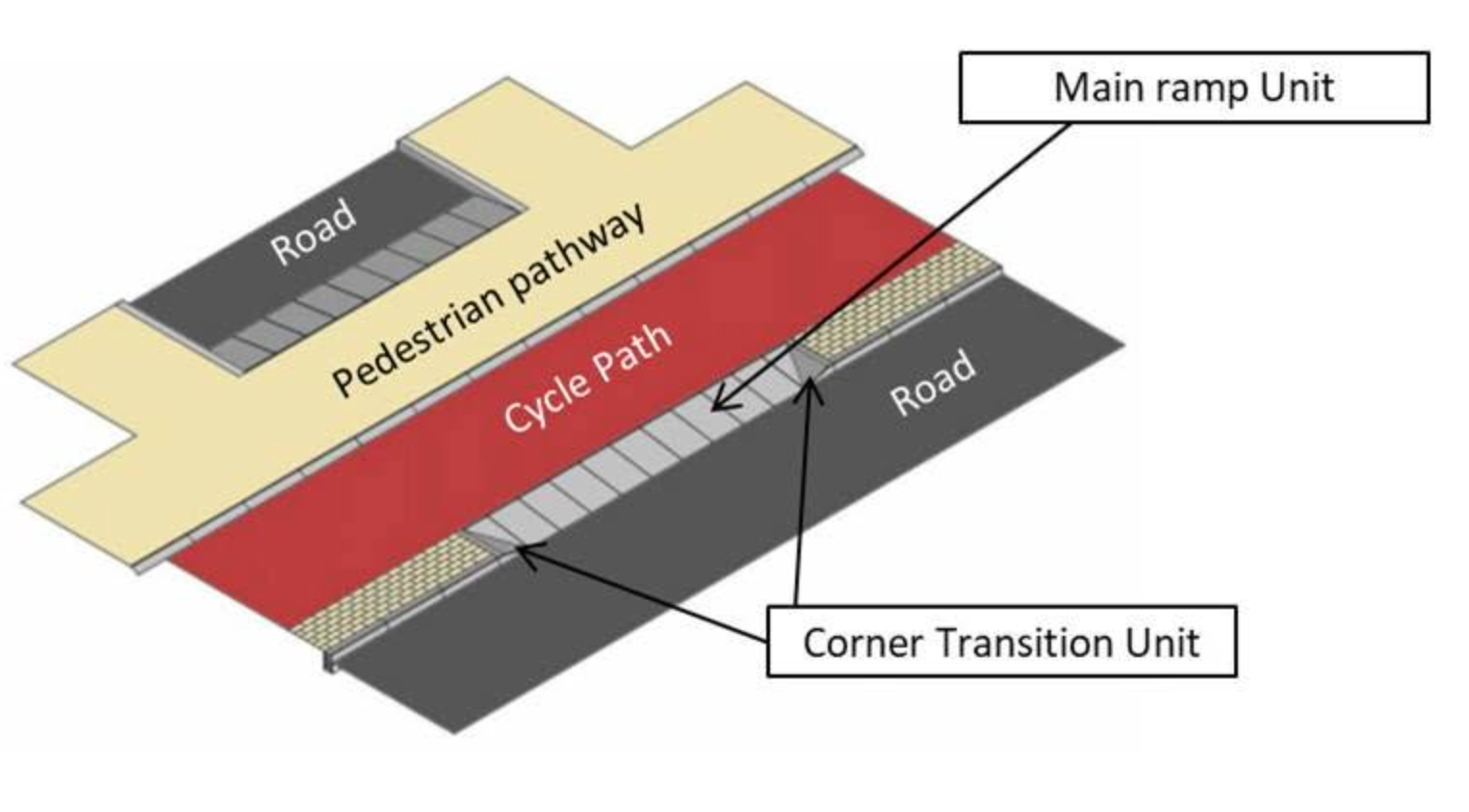
The NTA’s Typical Construction Details (TCD-1100 series) specify this continuous-crossing treatment at minor junctions in Ireland. A key part of the design is the use of special raised entrance kerbs - inritbanden in Dutch. Their steep rise forces motorists to slow down and emphasises that pedestrians and cyclists have priority over turning traffic. This has the further benefit of slowing traffic entering residential areas, where children might be at play. Until recently these kerbs were not manufactured in Ireland, but Irish suppliers have begun to offer them in 2025, and county councils such as Dublin City Council have started to use them.
On the Celbridge Road, however, entrances such as those to Rail Park, Lawrence Avenue, Maynooth Educate Together and Gaelscoil Uí Fhiaich are shown with what appears to be a raised table. Unlike an entrance kerb, a standard raised table does not assign priority to active travellers. With raised tables limiting space for pedestrians and cyclists by the use of quadrant shaped kerbing, priority is allocated to drivers.
[image: image.jpeg]
Photograph courtesy of Dutch Cycling Embassy
[image: image.png]
Photograph courtesy of Dutch Cycling Embassy
Recommendation 3 : Junctions with lesser roads should be designed with entrance kerbs on the basis of priority to continuing traffic (including pedestrians and cyclists) on the major road.
5.0 Disabled & Vulnerable Road Users
Older adults and vulnerable residents need space that is genuinely free of fast-moving vehicles including bicycles. High volumes of rapid traffic leave many feeling imprisoned in their own homes; reducing traffic and creating wider, protected public space would let wheelchair and mobility scooter users move through our community with real safety and confidence.
That consideration, however, must not be conflated with the needs of cyclists. Too often “shared space” is offered as the answer to both at once, and it serves neither well. As the Cycle Design Manual notes, shared space primarily benefits motor traffic at the expense of pedestrians and cyclists. Where vulnerable pedestrians are then mixed with cyclists travelling at 16–20 km/h on paths too narrow to share, the space that was meant to protect them becomes something they feel endangered by. We see this already on the Celbridge Road: adult cyclists ride on the footpath because they feel unsafe on the road. It is illegal, and it endangers pedestrians—but it shows what happens when one group’s need for safety is met by displacing the risk onto another. That should not be necessary.
New modes such as scooters, e-scooters and e-bikes will only deepen the problem. Folding every fast mode into “shared space” multiplies these conflicts and pushes them onto the people least able to get out of the way.
Recommendation 4 : Shared space must be the designer’s last choice, not the first. Vulnerable users need protected, low-speed space of their own, and not space shared with faster traffic of any kind including bicycles. In urban areas, cyclists and other “wheelers” need protected medium-speed space of their own, and not shared with faster or slower traffic.
5.0 Health and Economic Assessment Tool (H.E.A.T.)
H.E.A.T. is a spreadsheet developed by the World Health Organisation to assess the economic impact of different active travel schemes. It was also designed as a counterbalance to the Economic Impact Assessment (EIA) of road projects which invariably found that the project should proceed.
It is used as a management tool to measure the success of schemes. The outcome from H.E.A.T. can include quantifying the reduction in tonnage of carbon emissions and cost implications, the financial benefits of improved health and the number of premature deaths prevented. It can also be used to measure the ambition of schemes..
It is used in the United Kingdom, Italy, Finland, France, Germany and more than 70 other countries.
Recommendation 5 : Measuring and reporting on the success or otherwise of a scheme is an essential element in managing how a population decides to travel. Kildare County Council must apply H.E.A.T. to the Celbridge Road Active Travel Scheme in order to quantify and communicate the benefits of the scheme to the general public.
6.0 Conclusion
These proposals share a single aim: to make active travel the easy choice for families in Maynooth. We recognise some children will always need to be driven to school, and that option remains, even with a one-way system and safer walking and cycling infrastructure. Indeed, as more families choose to cycle or walk, more road space and parking is freed up for those who must drive.
The benefits of safe, active travel infrastructure are well-evidenced. The NTA’s Walking and Cycling Index 2025 found that walking, wheeling and cycling deliver almost €3 billion in economic benefit each year across Ireland’s five largest metropolitan areas, take up to 660,000 cars off the road each day, and in Dublin alone save the health service some €64.5 million and prevent 784 early deaths a year. Safer streets, less congestion, easier school runs, healthier children, and lower transport costs are not aspirations but measured outcomes. We all benefit.
The Celbridge Road scheme is a welcome and important step. With the improvements set out in this submission, it can secure those benefits for a generation of Maynooth families to come.